


This post will look at some of the remains of the Corps Line from Stowlangtoft to Ixworth. Ixworth itself was a Category B Nodal Point (I need to update the website page on Nodal Points to explain the categories for Eastern Command) and was garrisoned by men from "C" Coy, 2nd Battalion Suffolk Home Guard. As at 1941 the garrison strength was listed as 49 men with 34 rifles, six Browning light automatic rifles, three machine guns, two sub machine guns and two Northover projectors. In addition it was considered that an additional company of infantry and one troop of anti-tank guns would be necessary to hold Ixworth if it was attacked. From Ixworth north to Euston (to be covered in future posts) the River Black Bourn forms an obvious anti-tank obstacle.
At Stowlangtoft (a category C Nodal Point and in 1941 garrisoned by 28 men also from "C" Coy 2nd Battalion Suffolk Home Guard, with 20 rifles, two Browning light automatics and one machine gun) two Type 22 pillboxes can be seen. Both are overgrown with vegetation, one partially destroyed and one complete. In the complete pillbox some highly evocative graffiti can be seen: "THERE'LL ALWAYS BE AN ENGLAND AUG: 21 1940". I assume the damage to the partially destroyed pillbox was again a result of training during the War. These pillboxes, along with the one north of Stanton Street (see previous post) and the one north of Bridge Farm were obviously sited to cover the local road network, the A1088 leading to the Nodal point of Ixworth.


Above: Image 1 - over grown Type 22, Stowlangtoft
Image 2: "THERE'LL ALWAYS BE AN ENGLAND"
Image 3: Due to the road signs, the ivy is kept in trim and cannot hide the fact that there is a pillbox underneath it all!
Image 4: Inside of the ivy covered pillbox, clearly damaged presumably by wartime training. Note the wood shuttering used for the roof, the only one in the area as all the rest used corrugated iron sheets.
Image 5: Type 24, Bridge Farm just south of Ixworth.
Although work on the Inland Stop Lines was halted in Sept 1940, work on fortifying Nodal Points continued into 1941. My time in Ixworth was all too brief, a flying visit to look at sites already recorded on the Defence of Britain data base. As far as I know, no pillboxes survive in Ixworth or its surrounds, the only remains being that of road blocks. I visited two sites with recorded road block remains and had the pleasant surprise of coming across a third not on the data base.
But first the two sites already recorded. The first is near the old Priory and consists of several concrete cylinders that have now been incorporated into the river bank defences. The second, at the site of an old windmill, just to the south of Ixworth, consists of a number of concrete cylinders that have obviously been gathered from the surrounding area.
The site I came across and is not on the copy of the DOB data base I have is at Fulmer Bridge, Grimstone End. It consists of three cylinders by the side of a small bridge. It would be nice to think that these cylinders are where they were left during 1940, ready to close the road block - but I suppose they could equally have been put in their current position by the farmer to block off the gap between his gate and the bridge railings.This whole area is worthy of further exploration and to quote you know who: "I'll be back!"

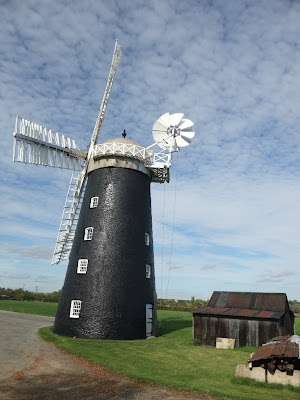


Image 6: Concrete road block cylinders now incorporated into the river bank to help prevent erosion.
Image 7 and 8: Concrete road block cylinders, old windmill south of Ixworth
Image 9: Concrete road block cylinders, Fulmer Bridge at Grimstone End.
No comments:
Post a Comment